 About two weeks after arriving in Dublin, my host Rotary Counselor invited my husband and me to dinner at her home. She lived just northeast of the city (about 9.5 miles) in the suburb of Howth (rhymes with "both").
Although we didn't get to see much of the town during our visit, the area was highly recommended for hiking, so Michael and I decided to go back one weekend and explore. Thus, this afternoon we boarded the DART (Irish Rail) and set off once again for Howth.
 Howth is a peninsula that juts out just north of Dublin Bay. It's still in County Dublin, though it has a completely different atmosphere. The port town harbor was full of both sail boats and fishing boats when we arrived.


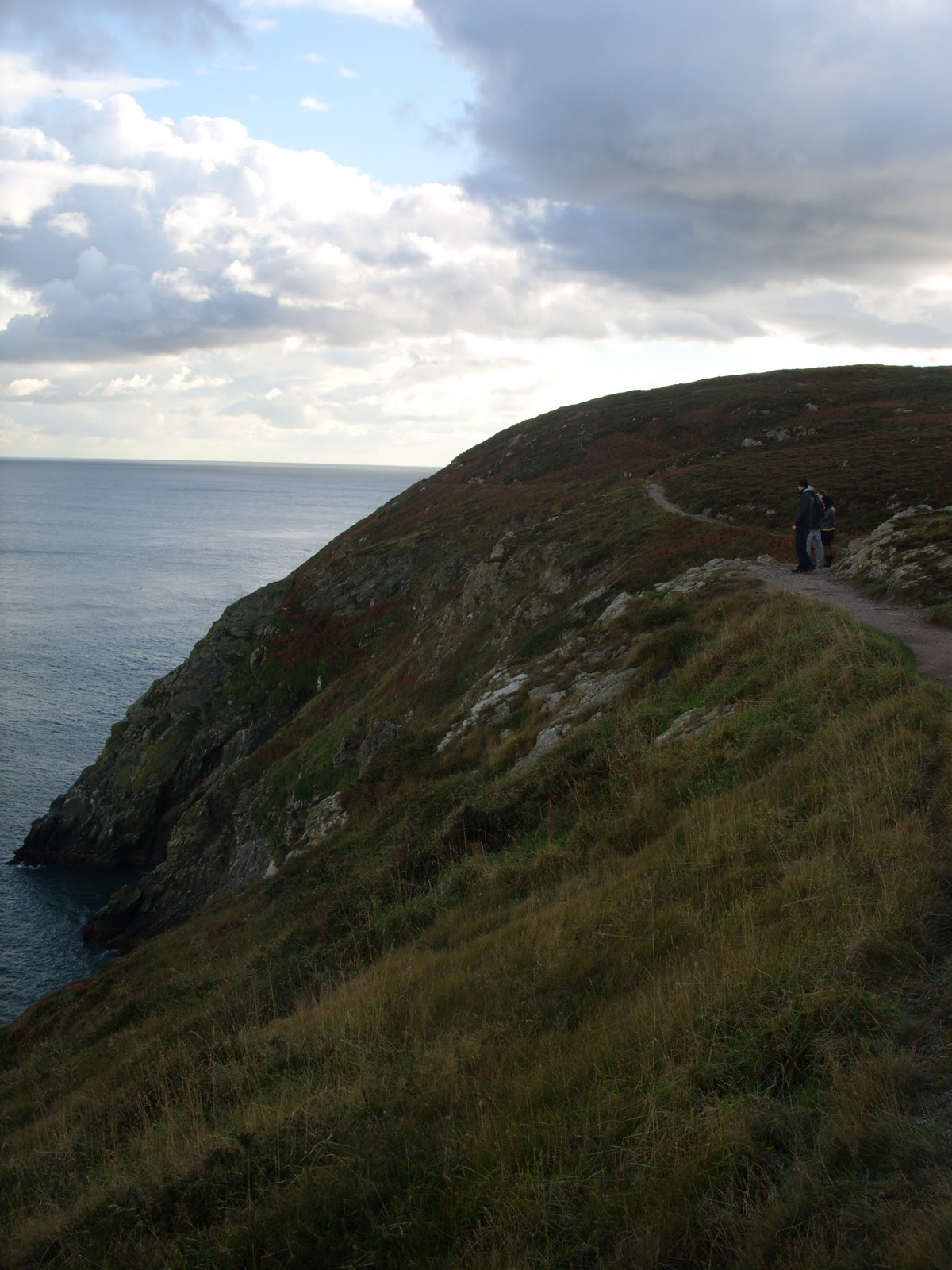 The cliffs offered 4 different trails: 6 km, 7 km, 8 km, and 10 km. As they all started out on the same path, we decided to see how things went before determining the trail. We took our time getting to the trail head and enjoyed the view as we walked up the path that lead to the cliffs.
 Despite the steady climb, the trail wasn't bad at all, and the scenery was breathtaking. We could see ships far out to sea, and the birds flying below us looked so far away. (At one point, we even saw some blackberries growing along the side of the cliff and stopped for a little snack.)
  Just before we reached the summit, the clear skies turned cloudy, and it began to rain. Despite being cold and wet, it was quite beautiful to be able to see the dark clouds right above us and the sun shining behind the clouds farther out to sea. (If you look closely at the photo, you can see a lighthouse on the very edge of the land. That will give you an idea of just how small everything seemed from that height.)
Having already passed the 6 km and 7 km trails, we decided to take the 8 km path instead of going on for the full 10 km. We headed off the cliff trail and hiked into the interior of the peninsula. At times we found ourselves walking through dense, wooded areas. It was much less scenic, with one exception. At one point, the trail took us through a grove of birch trees whose yellow leaves had covered the path. It was so beautiful, especially since the rain let up for a bit just as we were coming into it, that it was well worth hiking through all the mud to see it.
We eventually made it back to civilization after approximately 3 hours, and it even stopped raining toward the end. Overall it was a great day - especially when we celebrated our victorious athletic endeavor with some well-deserved ice cream!

Meg - save this pic for the "Where Do You Blue and Gold" contest in the Spring since you are wearing your Murray State shirt.
ReplyDelete